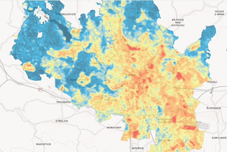
The result of satellite image analysis over time. Photo credit: data.brno.cz
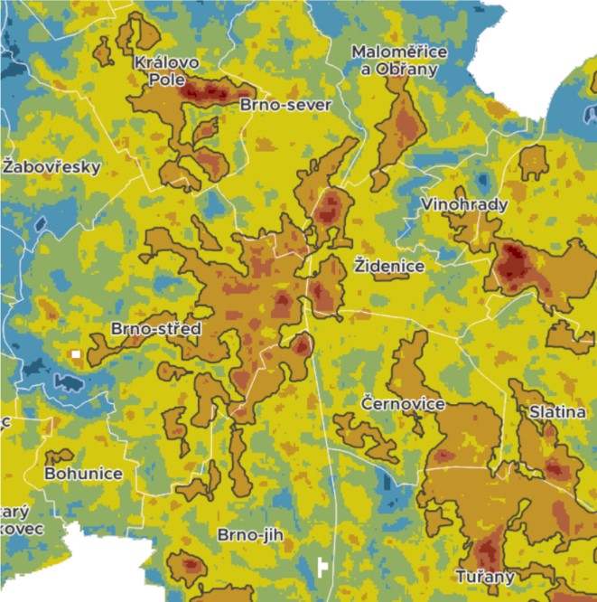
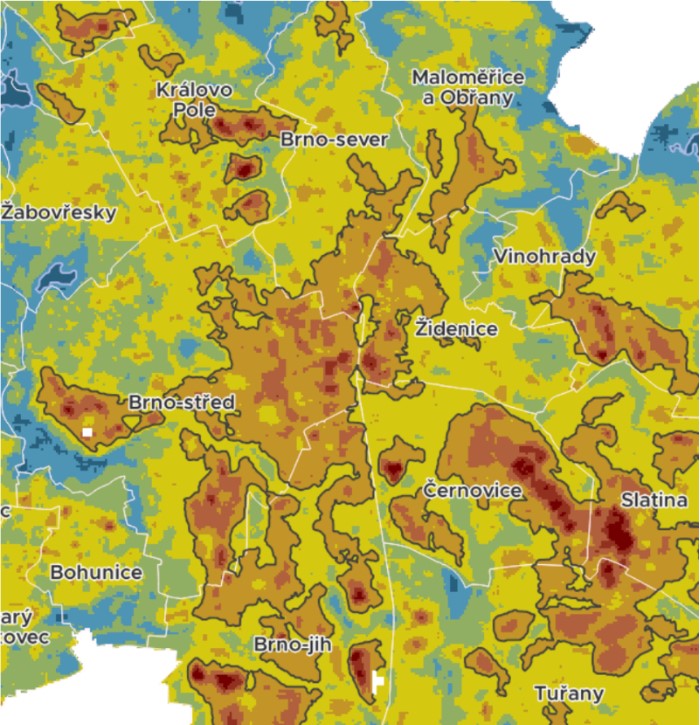
Brno, Aug. 23 (BD) – Brno’s average annual temperature has increased by 2°C over the past 60 years. One major contributor to the rise in temperatures is the continuous construction of houses, industrial buildings and large-scale commercial centres. The city’s heat island, that is, the built-up area that has significantly higher temperatures than its surroundings, is visible in the map above, which depicts its development and intensity from 1991 to 2021.
Based on satellite images, the most problematic part of the largest heat island area is the historic centre of Brno, in the eastern half of the Brno-Stred municipality, west of Židenice. However, the heat core also extends into Brno-north and Brno-south. The heat is positively influenced by the cooling effect of Špilberk Park and Zluty Kopec, and from the north also by Lužánky and the gardens between Černopolní and Drobného.
There has been considerable surface warming in Brno over the past three decades, especially in the suburbs, emerging or expanding industrial areas, and shopping centres. The most intense overheating occurs in the large industrial complex of Černovické terasy. Maximum surface temperatures are also related to complexes with a significant presence of unbroken flat roofs: including Královo Pole Shopping Centre, Avion Shopping Park with IKEA, and Futurum.
In comparison, since 2011 the most significant warming has occurred as a result of the extension of the northern part of the Černovická terrace and the construction of Brno Airport Park along the landing path of Tuřany Airport. Another example of increased temperature can be observed with the construction of the Hošek Motor complex on Vídeňská. A sharp spike in heat was also seen after the construction of a new residential complex in the Sadová district.


Comparison of heat island cores between 1991 (left) and 2021 (right); heat island boundary (in black). Credit: brno.data.cz
Construction sites are characterised by the absence of vegetation: the exposed soil absorbs large amounts of heat without a regulating factor. Several years after the completion of a residential complex, even when vegetation has grown in the space between the buildings, these sites continue to be overheated, albeit less intensely. Only after the trees have reached a mature stage do they provide a cooling effect.
In general, built-up areas seem to be the hottest during summer months, however overheating also occurs on agricultural land. Fields cool their surroundings considerably in the period leading up to harvest. After harvest, on the other hand, the bare ground overheats, absorbing similar amounts of heat as urban surfaces.
Based on the evolution of the total heat island area of the city of Brno, it appears that overheated surfaces are steadily increasing, at a rate of three square kilometres every 10 years from 1991 to 2011. However, in the last decade the growth rate of the city’s heat island area slowed to 1.3 square kilometres.
Water resources are the most effective landscape feature for cooling. In Brno, the most important of these are the Brno Dam, the Holásecká lakes and the Chrlice biotope. River floodplains also cool the surrounding environment, especially near the Svratka and Svitava rivers. However, because of their larger area, forests are the main cooling elements in the Brno climate, especially in valleys or on north-facing slopes such as in the northern half of Ořešín or the part of the Moravian Karst Area in Líšen. This underlines the importance and necessity of balancing urban areas with natural spaces.
However, the significant change in temperatures may not only be due to the drastic change in surface use. In Nova Mosilana, for example, the landscape coverage has remained the same over time, but there has been a clear change in the colour and material of the roof of the eastern building. The darker surface now absorbs much more heat. On the western roof, the colour and material remained unchanged and there was no significant increase in surface temperature.
The dataset used contains for each time period the average surface temperature, extreme values, and normalised value. The maps compare the surface temperature and its variation over a 30-year period and the heat island boundary of the City of Brno for the period 1991-2021. The information was obtained from LANDSAT 5, 7 and 8 satellite data from the summer period (June-August) of the previous five years for the time periods 1991, 2001, 2011 and 2021.
For further detailed information on the research visit: https://data.brno.cz/


