
New data released by the City of Brno and its companies is shedding more light on how the city works under the hood. The 2025 Brno emotional map provides a unique view of the city as people really experience it – every day, on the way to work, to school, on a walk in the park or while waiting for the tram. Meanwhile the release of data from traffic sensors reveals a lot about how Brno’s residents use the city.
An emotional map of Brno
Respondents to the emotional map answered questions about which places have recently improved, where is worth visiting, where they do not feel safe, and where the city should continue to develop. From May to October 2025, 1,714 respondents participated in the mapping, entering almost 27,000 points and hundreds of personal comments into the map. The result is six maps that show which places are on the up or on their way down, what changes are needed in the city, and which are the city’s best spots.
“The map clearly shows revitalized squares, parks, riverbanks, and newly revitalized brownfields,” said Petr Bořecký, Brno city councillor for participation. “It is there that people most often talk about positive change, greenery, meeting space, and a better atmosphere.”
But problematic locations also appear just as clearly – often around transport hubs, neglected public spaces, or areas perceived as risky/dangerous. The themes of congested traffic, noise, clutter, visual smog and social problems are recurring. The emotional map thus functions as a sensitive “seismograph” of everyday experience.
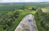
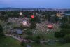
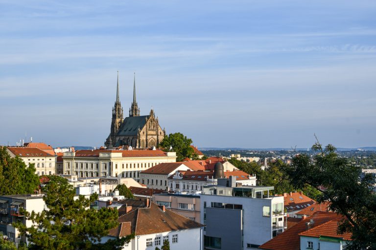
In terms of leisure, natural areas, parks, rivers and the associated walking opportunities naturally dominated. When people recommend Brno for a visit, they reach for historical landmarks, the city center, large parks and viewpoints. However, the appeal of Brno is not just about the monuments, but also the atmosphere and cultural life of the city. This emotional map includes new locations such as Rullerovo nábřeží, the iconic Kamenka art colony, the reservoirs on Žlutý kopec, and the viewpoint on Bílá hora.
The final map shows that the public does not see development as further expansion of the city into its surroundings. On the contrary, people want Brno to develop inward: to utilise brownfields, improve the daily functioning of the city, invest in high-quality public space, pedestrian and bicycle traffic, greenery and safety.
“The emotional map gives us specific stimuli, not general phrases. It shows where people really feel the changes – and where they are still waiting for them. It is these subtle but recurring signals that are extremely valuable for the city’s strategic planning. All the more so because we have data from previous surveys from 2016, 2018 and 2022 for comparison.” added Martin Příborský, the city’s representative for strategic development .
A detailed analysis of all six maps, a selection of more than 900 comments, and an interactive map application are available on this story map.
Brno opens up data from traffic sensors
Meanwhile, thanks to the initiative of the Department of Transport, the City of Brno Department of Participation, and the company Technické sítě Brno, several years of data from various types of traffic counters and sensors have been released to the public online. These sensors have long been monitoring the number of pedestrians, runners and cars moving around Brno, which is now available to all.
The new website includes data from more than 30 automatic traffic counters. More should be added in the future, thanks to the involvement of other operators. In addition, data from sensors should gradually be expanded to include data from traffic cameras at intersections equipped with object and vehicle detection technology. The current data is through sensors from Brněnské komunikace and Technické sítě Brno.

“Each counter fulfills a different role,” explained Petr Kratochvíl, Brno city councillor for transport. “While some measure traffic intensity with a resolution for vehicles, others may be focused on parking statistics or leisure time, such as walking or running. Thanks to advanced analyses, we can reveal, for example, the direction of movement of the object in question, whether it is a car, bicycle, or person.”
The output is clear data on the number of people, cyclists and cars who have passed or driven through a given location. Thanks to the continuous operation of the sensors, it is possible to monitor the occupancy of parking spaces or the number of pedestrians and cyclists at different times. The Department of Transport primarily uses the data to evaluate the effectiveness of transport measures and monitor traffic intensity, which helps the development and coordination of changes to the city’s transport infrastructure.
On the website, visitors will find a central dashboard that visualizes data from individual locations with counters, allows for their filtering, shows a clear interactive map showing the location of sensors in the city, and also the dataset itself with data on the number of passages and journeys per hour, direction of movement, and more.
“The counters do not violate people’s privacy at all, because they do not record any images or store personal data,” added Bořecký. “All detections and calculations take place directly in the device and only anonymous vehicle or pedestrian counts are subsequently sent to the database.” He added that the software uses artificial intelligence – the camera records the scene, but selects only key points from it that describe movement. The sensor does not track specific people or their behavior, but only recognizes their trajectory and whether they are pedestrians, cyclists, runners or, possibly, cars.