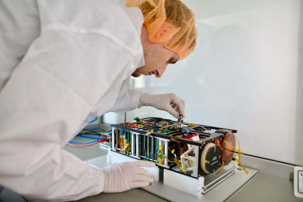
This autumn, the Czech Republic will join the handful of countries using its own satellite equipped with a hyperspectral camera. Launched into Earth’s orbit by the TROLL satellite, developed by the Brno space company TRL Space, the camera will provide highly detailed images suitable for a wide range of uses, thereby significantly improving the capacity for monitoring and analysing phenomena on Czech territory.
The first user of this advanced technology will be the Czech Environmental Inspectorate (ČIŽP), which will obtain detailed and accurate information for surveillance activities thanks to the hyperspectral imaging technology.
Unlike a regular camera, a hyperspectral camera can capture images in multiple colours, which enables a very detailed resolution of various phenomena based on their specific light reflection. Thanks to this, this camera has great potential for detecting environmental problems, such as illegal landfills and constructions, deforestation, and pollution of waterways, or monitoring the state of vegetation. It is for these purposes that ČIŽP plans to use the images.
“Thanks to this advanced technology, we will be able to refine our surveillance activities and detect illegal damage to the environment, which we would otherwise not even know about,” said Petr Bejček, director of ČIŽP.
Cooperation with leading scientists from Charles University and GISAT
The cooperation with ČIŽP is part of a wider project supported by the Czech Technology Agency (TAČR), and is led by a team from the Department of Applied Geoinformatics and Cartography of the Faculty of Science of Charles University, who are responsible for developing the methodology for the acquisition and processing remote sensing data.
“In the project, we aim to find out how we can use data from remote sensing of the Earth, whether satellite, aerial or purchased drones, for specific use by the application guarantor, i.e. the Czech Environmental Inspectorate,” said Lucie Kupková from the Faculty of Natural Sciences at Charles University.

GISAT s.r.o. will be in charge of analytical data processing. “Satellite images are becoming more available, but the key is to use them correctly. In the project, we will select and analyse suitable images from non-commercial and commercial satellites,” said Jan Kolomazník, project manager at GISAT.
Opening a new market
In addition to ČIŽP, satellite images from the hyperspectral camera will be available to any institution or entity in the Czech Republic and abroad. The satellite is only due to fly over the Czech Republic every other day. TRL Space wants to start the first imaging of Europe this autumn.
“We are treading a new, commercial path,” said Petr Kapoun, CEO of TRL Space. “We invested in building and launching our own satellite. We will operate it and sell the data from it. This means that, in addition to building customised satellite missions for customers (which is our main business), we are venturing into a new market following the example of the West. The sale of data generates millions of crowns annually and moves our company and team to the next great stage. I am happy that we have our first customer in the Czech Republic.”
TROLL is a satellite with a hyperspectral camera, which is not only unique within the Czech Republic, but is also very rare on a global level, as there are still only an extremely small number of satellites providing high-resolution images from Earth’s orbit.
“There are few units in orbit of high resolution hyperspectral camera satellites,” said Petr Boháček, strategy manager from TRL Space. “Hyperspectral images are also very demanding to process and use. In addition, similar satellites do not cover the Czech Republic as a priority. Thanks to access to this data, the Czech Republic will have a unique opportunity to use the enormous potential of hyperspectral data for agriculture, environmental protection and security.”
New technologies
In addition to the hyperspectral camera, the TROLL satellite will also be equipped with artificial intelligence software from the sister startup Zaitra, which will deal with the so-called onboard data processing — the evaluation of data directly on board the satellite. In addition, new software for encrypted communication from another sister company, Corac, will ensure the security of the signal transmission between Earth and the satellite.


